
Stand at Giza today and the pyramids sit in open desert. There is no water in sight.
That has always been the awkward part of the story. Egyptians moved millions of limestone blocks to a site with no obvious way of getting them there, and then built thirty-one pyramids in a line along the edge of the Sahara.
In 2024 a team using satellite radar found the missing piece. A branch of the Nile roughly sixty-four kilometres long once ran directly past them, and the causeways of those pyramids end exactly where its banks used to be.
The river had moved. Everything else about Egypt makes more sense once you understand that the Nile was not a feature of the landscape. It was the reason there was a country at all.
In brief: The Nile mattered to ancient Egypt because it flooded on a predictable annual cycle, depositing fertile silt across an otherwise sterile desert. That flood set the calendar, determined the tax assessment, watered every crop, and carried the stone that built the monuments. Egypt had almost no rainfall — the river was the entire water supply.
Myth Versus Evidence
| What people assume | What the evidence shows |
|---|---|
| The Nile flooded because of rain in Egypt | Egypt gets almost no rain. The flood came from the summer monsoon over the Ethiopian highlands, 2,000 km upstream |
| Flooding was a disaster | It was the opposite. A weak flood meant famine. Egyptians measured it obsessively and taxed according to its height |
| The river has always run where it does now | It has shifted repeatedly. A major branch beside the pyramids dried up and vanished under farmland and sand |
| The Nile flows south because it is “down” on the map | It flows north. Upper Egypt is in the south because it is upstream |
| The annual flood still happens | It ended in 1970. The Aswan High Dam stopped it permanently |
Where the Water Came From
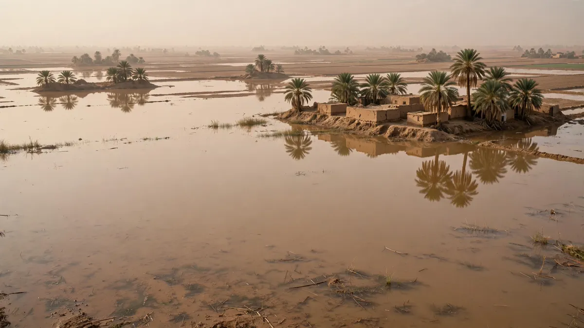
Egyptians could see the flood arrive every summer. They could not see why, because the cause was two thousand kilometres away in a country they had never mapped.
The Nile has two main feeders that meet at modern Khartoum.
- The White Nile rises in the East African lakes and flows steadily year-round. It supplies the river’s baseline.
- The Blue Nile rises at Lake Tana in the Ethiopian highlands. For most of the year it is modest. When the summer monsoon breaks over Ethiopia, it becomes a torrent.
At flood peak the Blue Nile supplies the overwhelming majority of the water reaching Egypt — and, more importantly, almost all of the silt. That silt is volcanic soil stripped off the Ethiopian highlands and carried a full two thousand kilometres downstream.
Egyptian agriculture ran on topsoil imported annually, by river, from another country, by accident.
The black land and the red land
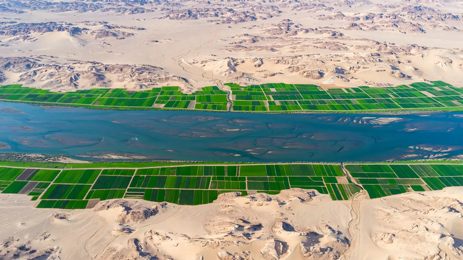
Egyptians called their country Kemet — the black land — after the colour of that deposited silt. The desert on either side was Deshret, the red land.
The boundary between them was not gradual. You can stand today with one foot on irrigated black soil and the other on sterile sand. That line is where Egypt ended, and it is the reason the country was shaped like a ribbon rather than a territory — as our ancient Egypt map guide sets out.
The Three Seasons
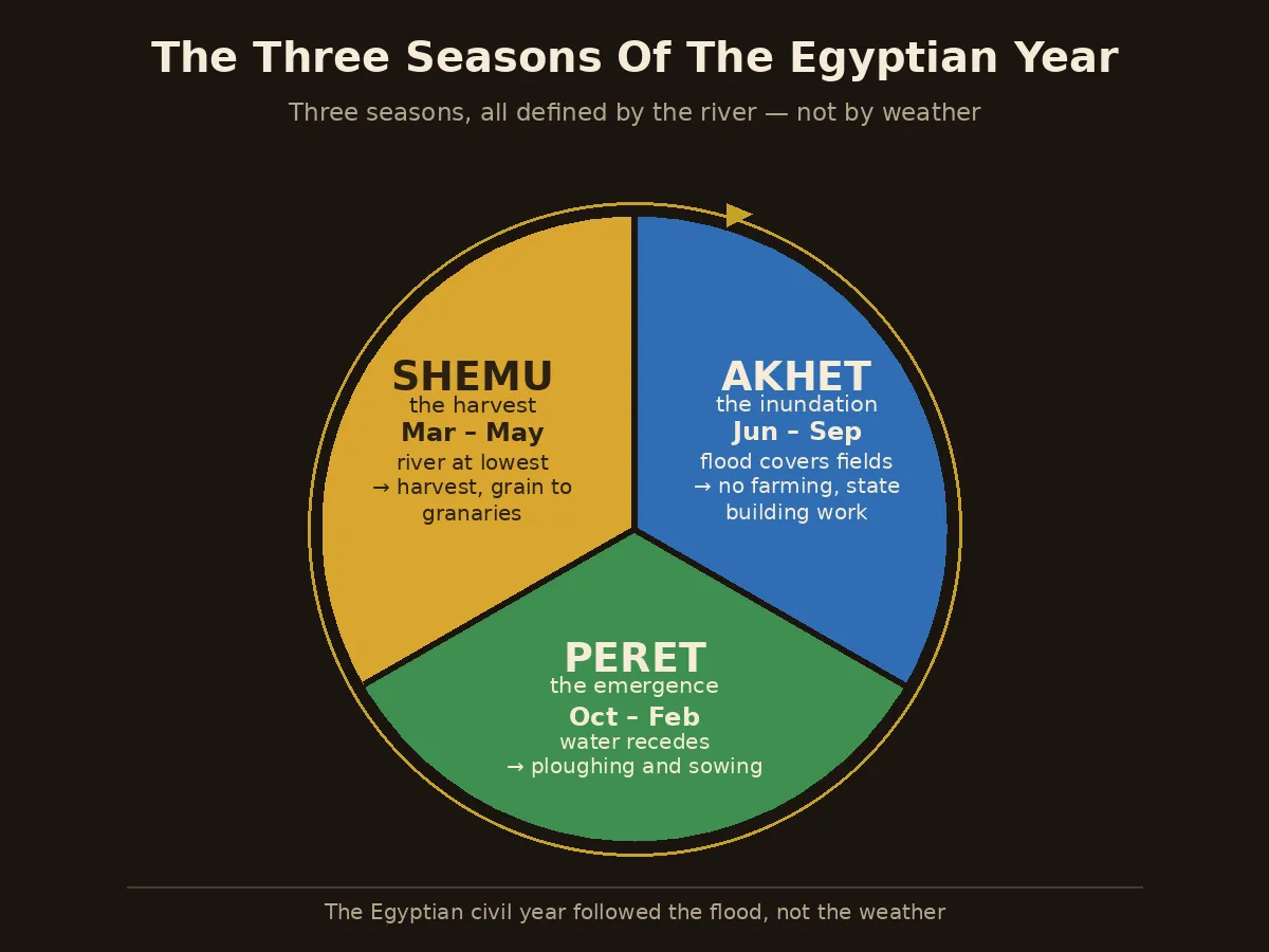
Egypt did not have spring, summer, autumn and winter. It had three seasons, and all three were defined by the river.
| Season | Roughly | What the river was doing | What people did |
|---|---|---|---|
| Akhet “Inundation” | June – September | Flood covers the floodplain | No farming possible. Labour shifted to state building projects |
| Peret “Emergence” | October – February | Water recedes, leaving wet silt | Ploughing and sowing into the fresh deposit |
| Shemu “Low water” | March – May | River at its lowest | Harvest, threshing, grain into state granaries |
The Akhet row explains something people often find puzzling. During the flood there was no farmwork to be done, and the entire agricultural workforce was idle for three months at exactly the point when the river could float heavy stone. That is not a coincidence — it is the labour model behind how the pyramids were built.
How the Flood Ran the Government
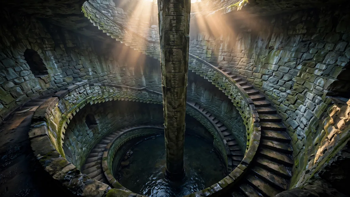
A flood that was too low meant a poor harvest. A flood that was too high washed away villages and canals. The margin between the two was about a metre.
So Egypt measured it. Nilometers — staircases or shafts cut down to the water with graduated markings — were installed at key points along the river, often inside temple precincts. Officials read the level as the flood rose and reported it.
That reading did two things.
First, it forecast the harvest months before it happened. Second, and more consequentially, it set the tax. Egyptian taxation was assessed on expected yield, and expected yield was a function of flood height — so the number a priest read off a wall in July determined what a farmer owed the following spring.
The record-keeping this required is described in our articles on the ancient Egypt census and on Egypt’s government.
Hapi was not the god of the Nile
A small but persistent error. Hapi was the god of the inundation — the flood itself, not the river.
He is depicted as a heavy-set figure with pendulous breasts and a belly, carrying offerings: a deliberately fertile, well-fed image representing abundance rather than water. Egyptians did not deify the Nile as an entity. They deified the event that made the country work.
The River as a Two-Way Road
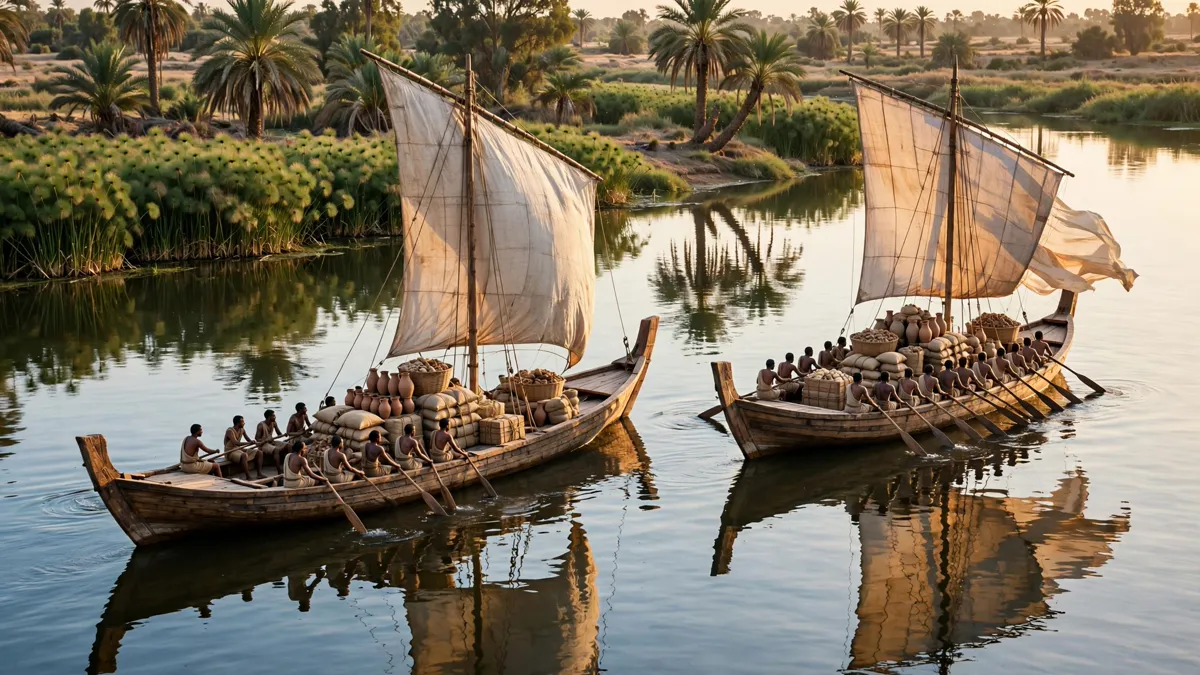
Egypt had an unusual geographical advantage, and the writing system records it.
The current flows north. The prevailing wind blows south. That means a boat could drift downstream with the current, then raise a sail and be pushed back upstream against it — a two-way highway running the length of the country, powered by nothing.
The Egyptians built this into their language. The hieroglyph meaning “to travel south” is a boat with its sail up. The sign meaning “to travel north” is a boat with the sail down.
Direction and method were the same idea. You can see how such signs worked in our guide to Egyptian hieroglyphs.
This is also why Egypt unified early and stayed unified. A message, an army or a tax collector could reach any point in the country by water. Compare that with contemporaries who had to cross mountains or deserts to hold territory together.
The Branch That Disappeared
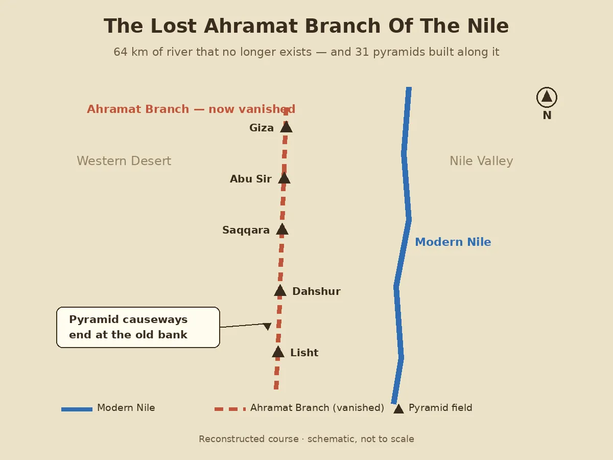
In May 2024, a team led by Eman Ghoneim of the University of North Carolina Wilmington published a finding that resolves the Giza problem.
Ghoneim, a geomorphologist who grew up in Egypt, had spotted faint traces of a channel in multispectral satellite imagery — wavelengths of light the eye cannot see. The team then confirmed it from the ground using ground-penetrating radar and electromagnetic tomography, and finally by drilling.
The cores came up at about twenty-five metres depth holding sand, not clay or silt. Sand at that depth means running water once moved through it.
The study was published in Communications Earth and Environment. They named the channel the Ahramat Branch, from the Arabic word for pyramids.
What it looked like
| Length traced | About 64 km, from Giza south towards Lisht |
| Width | Roughly half a kilometre in places |
| Depth | At least 25 metres — comparable to the Nile today |
| Pyramids alongside it | 31, spanning the 3rd to 13th dynasties |
| What survives | The Bahr el-Libeini canal near Abu Sir |
Why it matters
The decisive detail is the causeways. Many pyramids have a raised stone walkway running from the pyramid down to a valley temple — and those valley temples terminate precisely at the reconstructed banks of the Ahramat Branch.
They were harbours. Stone arrived by boat, was unloaded at the valley temple, and went up the causeway to the site. The building materials for a plateau that now sits in open desert came by water.
Where it went
The team suggests a combination of causes: the branch migrated eastward, windblown sand encroached following a major drought around 4,200 years ago, and river discharge declined as the region grew more arid. Tectonic movement may also have contributed.
Ghoneim has been careful about the timing, noting there is no exact date for when the branch ceased to function. Nick Marriner, a geographer at France’s CNRS who was not involved, described the work as completing an important part of the landscape puzzle rather than closing the question.
One consequence is worth noting: if settlements and temples lined that bank, they are now under farmland and sand. The study effectively hands archaeologists a map of where to dig next.
The Flood Stopped in 1970
The cycle that defined Egypt for five thousand years ended within living memory.
The Aswan High Dam, completed in 1970, holds the flood water in Lake Nasser and releases it through the year. Egypt gained reliable irrigation, hydroelectric power and protection from both drought and destructive floods.
It also stopped the silt. That fertile volcanic soil now settles behind the dam instead of on the fields, and Egyptian agriculture runs on manufactured fertiliser in its place. The Delta, no longer resupplied with sediment, is eroding.
Whether that trade was worth making is a live argument in Egypt. What is not in dispute is that the river the pharaohs organised their entire civilisation around no longer behaves the way it did.
What We Know and What We Don’t
Established by evidence
- The annual flood was driven by the Ethiopian summer monsoon, not by rain in Egypt
- The Blue Nile supplied most of the floodwater and nearly all the silt
- Egypt’s three seasons were defined by the flood cycle
- Nilometers measured flood height, and that measurement set tax assessments
- Current flowing north and wind blowing south made the river a two-way route
- A major Nile branch once ran past 31 pyramids and has since vanished
- Pyramid causeways terminate at valley temples on that former bank
- The annual flood ended with the Aswan High Dam in 1970
Still unresolved
- Exactly when the Ahramat Branch ceased to be navigable
- How many other extinct Nile branches remain unmapped
- What settlements and temples lie buried along the old bank
- How much Egyptians understood about the flood’s distant cause
- How far the branch extended beyond the 64 km traced so far
Frequently Asked Questions
Why was the Nile River important to ancient Egypt?
Because Egypt had almost no rainfall, so the river was the entire water supply. Its annual flood deposited fertile silt that made farming possible in a desert, set the calendar and the tax system, and provided a transport route the length of the country.
Why did the Nile flood every year?
The summer monsoon over the Ethiopian highlands swelled the Blue Nile, which reached Egypt weeks later as a flood. Egyptians could see the effect but not the cause, which was about two thousand kilometres upstream.
Which direction does the Nile flow?
North, into the Mediterranean. This is why Upper Egypt is in the south and Lower Egypt in the north — the names follow the river, not the map.
What is a nilometer?
A graduated staircase or shaft cut down to the water to measure flood height. Officials read the level as the flood rose, which forecast the harvest and set that year’s tax assessment.
Did a branch of the Nile run past the pyramids?
Yes. A 2024 study led by Eman Ghoneim identified a 64-kilometre branch, named Ahramat, running past 31 pyramids. Pyramid causeways end at valley temples on its former banks, indicating they served as river harbours for delivering stone.
Does the Nile still flood?
No. The Aswan High Dam, completed in 1970, holds the flood in Lake Nasser and releases water through the year. The silt that once fertilised the fields now settles behind the dam.
Conclusion
Herodotus called Egypt the gift of the Nile, and the phrase has been repeated so often it has stopped meaning anything.
What the evidence shows is more specific and more interesting. The calendar was the flood. The tax was the flood. The labour available to build pyramids existed because the flood made farming impossible for three months a year. The stone arrived on water that is no longer there.
And the river has moved before. The pyramids look stranded in desert because they are — the water walked away and left them.
Sources and Further Reading
- Ghoneim, E. et al. (2024). “The Egyptian pyramid chain was built along the now abandoned Ahramat Nile Branch.” Communications Earth and Environment 5, 233.
- University of North Carolina Wilmington — announcement and methodology summary.
- Scientific American — coverage including Ghoneim on the sediment cores.
- Smithsonian Magazine — including independent comment from Nick Marriner of the CNRS.